1
Pedestal 1
2
Pedestal 2
3
Pedestal 3
4
Pedestal 4
5
Pedestal 5
6
Pedestal 6
7
Pedestal 7
8
Pedestal 8
9
Pedestal 9
10
Pedestal 10
11
Pedestal 11
12
Pedestal 12
13
Pedestal 13
14
Pedestal 14
15
Pedestal 15
16
Pedestal 16
17
Pedestal 17
18
Pedestal 18
Memorials
History
Vehicles
Structures
1
Granite Commemorative Stone
Click to view details
2
Buffalo Nine Memorial
Click to view details
3
Stone Path & Pedestals (1-6)
Click to view details
4
Pedestals (7-10)
Click to view details
5
Pedestals (11-14)
Click to view details
6
Pedestals (15-18)
Click to view details
7
LAV III Monument
Click to view details
8
Wall of Honour
Click to view details
9
UN Guard Post
Click to view details
10
Bringing Their Faces Into The Light
Click to view details
11
Korea Missions Plaque
Click to view details
12
Lynx Vehicle
Click to view details
13
Pedestal 13
Click to view details
14
Pedestal 14
Click to view details
15
Pedestal 15
Click to view details
16
Pedestal 16
Click to view details
17
Pedestal 17
Click to view details
18
Pedestal 18
Click to view details
About the Park Map
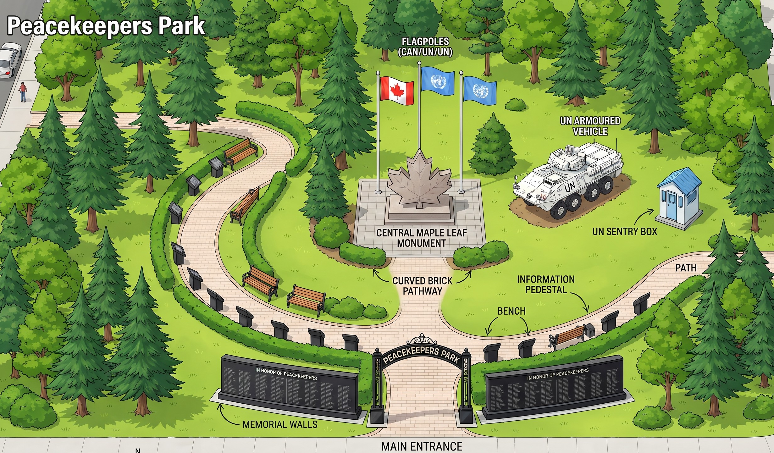
This illustrated map shows the layout of Peacekeepers Parks at 12 Commerce Road, Angus, Ontario. The park features a winding stone path connecting all major monuments and memorials. Hover over (desktop) or tap (mobile) any numbered point to learn more about that feature. The 18 pedestals along the path document Canada's 59 UN peacekeeping missions since 1949.
Getting to Peacekeepers Parks
Open in Google Maps
Located near Canadian Forces Base Borden in Angus, Ontario. The park is at the intersection of Commerce Road and Mill Street.
1
Feature Title
Description